
Home
/
HEMA Outback Queensland Map: Camooweal to Stanthorpe - 5th Edition


HEMA Outback Queensland Map: Camooweal to Stanthorpe - 5th Edition
Quantity
Detail
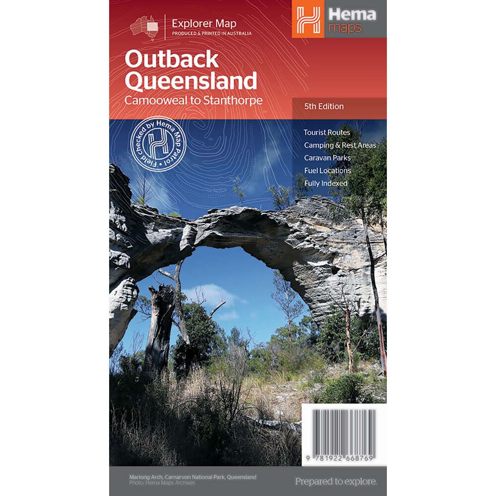
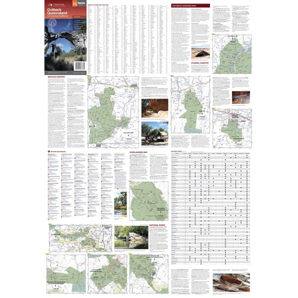
The HEMA Outback Queensland Map: Camooweal to Stanthorpe is here to aid in your next outback journey! Outback Queensland (QLD) contains mapping and visitor information for one of the most iconic regions in Australia. Mapping at a scale of 1:1,500,000 covers from the inland borders to Toowoomba in the east and Charters Towers in the north, with hill shading and elevation tinting creating a more realistic interpretation of the landscape within the region. Accompanying the mapping is extensive visitor information for the Channel Country, Matilda Country and the Overlanders Way, with a town and locality index in addition to necessary contact details covering the majority of information for touring the region. Also included are maps of Bladensburg, Idalia, Currawinya, Diamantina and Carnarvon Gorge national parks.
Features
- Produced and printed in Australia
- Tourist routes
- Covers camping and rest areas
- Caravan parks
- Fuel locations
- Fully indexed
Customer Reviews
SEE ALL
You May Also Like
80%
OFF
HEMA Outback Queensland Map: Camooweal to Stanthorpe - 5th Edition
AU$ 2.99
AU$ 14.95
80%
OFF
HEMA Outback Queensland Map: Camooweal to Stanthorpe - 5th Edition
AU$ 2.99
AU$ 14.95
80%
OFF
HEMA Outback Queensland Map: Camooweal to Stanthorpe - 5th Edition
AU$ 2.99
AU$ 14.95
80%
OFF
HEMA Outback Queensland Map: Camooweal to Stanthorpe - 5th Edition
AU$ 2.99
AU$ 14.95
80%
OFF
HEMA Outback Queensland Map: Camooweal to Stanthorpe - 5th Edition
AU$ 2.99
AU$ 14.95
80%
OFF
HEMA Outback Queensland Map: Camooweal to Stanthorpe - 5th Edition
AU$ 2.99
AU$ 14.95
80%
OFF
HEMA Outback Queensland Map: Camooweal to Stanthorpe - 5th Edition
AU$ 2.99
AU$ 14.95
80%
OFF
HEMA Outback Queensland Map: Camooweal to Stanthorpe - 5th Edition
AU$ 2.99
AU$ 14.95